
What is a Hydrographical Survey and Why is It Important?
hydrographical survey involves the measurement and mapping of water bodies, including rivers, lakes, coastal areas, and underwater topography. It’s essential for projects involving water resources, coastal development, navigation, flood control, and environmental monitoring. Hydrographical surveys provide crucial data on water depths, currents, tides, and underwater features, enabling accurate planning and design for a range of projects, from bridges and dams to ports and flood defenses.
ARMM Engineering & Consultants specializes in hydrographical surveys across Odisha and India, providing reliable, detailed data to ensure the success of your water-related projects.
Key Elements of a Hydrographical Survey
Hydrographical surveys collect data on various aspects of water bodies. Here are the key components:
- Water Depth Measurement
Accurate depth measurements are crucial for navigation, construction of piers or docks, and ensuring the safety of maritime operations. - Underwater Topography
Mapping underwater features like rocks, shoals, and other obstacles helps in designing safe structures like bridges, dams, or ports. - Current and Flow Analysis
Understanding water flow, currents, and tides is vital for flood management, coastal protection, and designing structures that won’t be undermined by shifting water patterns. - Sediment and Substrate Mapping
Identifying sediment types and underwater substrates is key for construction projects that require anchorage or support structures on the seafloor or riverbed. - Flood and Erosion Risk Assessment
Hydrographical surveys help assess the risk of flooding and erosion in riverbeds, coastal areas, or reservoirs, informing flood control measures and long-term planning.
The Benefits of a Hydrographical Survey
Informed Design and Planning
With accurate data on water bodies, construction projects such as bridges, ports, and dams can be better designed to accommodate water flow, depth, and other environmental factors.
Safe Navigation
Hydrographical surveys are essential for ensuring that waterways are navigable and safe for vessels, reducing the risk of accidents and improving maritime operations.
Flood Risk Management
By analyzing currents, water depths, and flood patterns, hydrographical surveys help in designing effective flood defenses and improving disaster preparedness.
Environmental Protection
Surveys can also monitor the health of aquatic ecosystems by providing data on water quality, sediment levels, and biodiversity, which is essential for environmental conservation efforts.
Regulatory Compliance
Many environmental and construction projects require hydrographical data for compliance with regulations governing waterway usage, flood management, and coastal protection.
Why Choose ARMM Engineering & Consultants for Your Hydrographical Survey?
At ARMM Engineering & Consultants, we bring years of expertise and advanced technology to every hydrographical survey. Our experienced team uses state-of-the-art equipment and techniques to gather precise data on water bodies, ensuring that your project is built on a solid understanding of the aquatic environment.
Whether you’re planning a port, a dam, a river crossing, or need flood risk assessment, we provide accurate and reliable hydrographical survey services across Odisha and India, delivering detailed reports and actionable insights for your project.
Our Hydrographical Survey Process
Initial Consultation
We begin with a consultation to understand the scope of your project and specific requirements for the hydrographical survey.
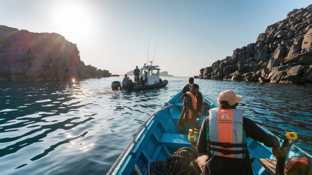
Survey Planning and Site Exploration
Our team plans the survey, determining the best methods and equipment to accurately collect data on water depths, currents, and underwater features.
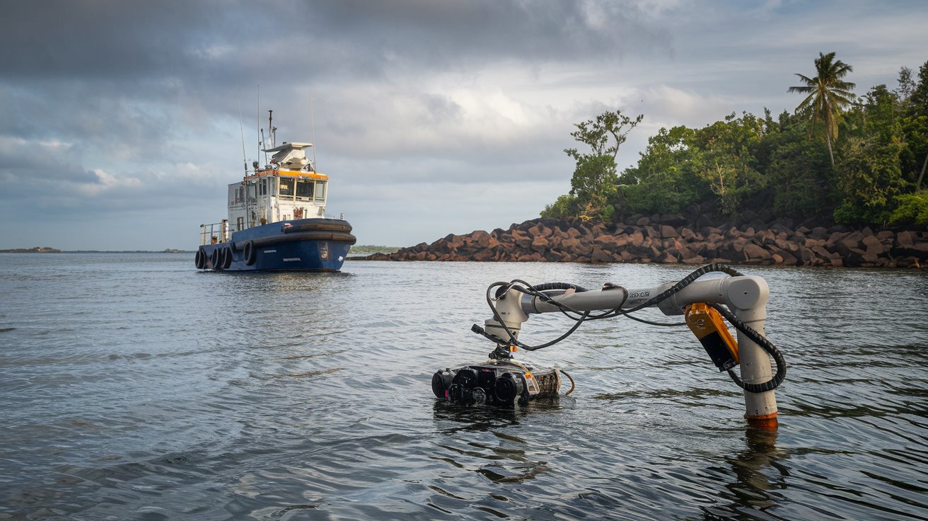
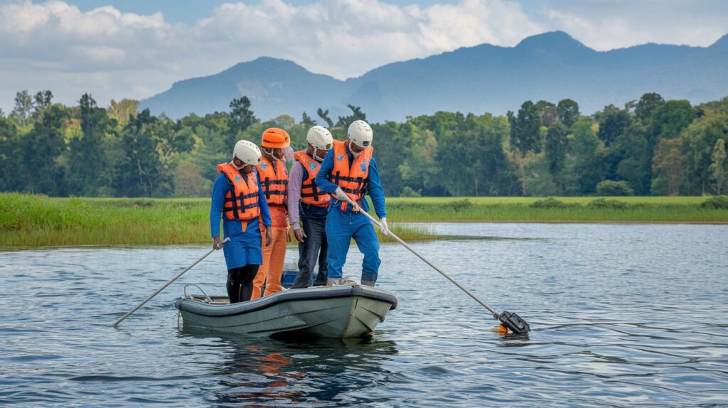
Data Collection
Using advanced sonar equipment, GPS, and other specialized tools, we gather precise data on the water body’s depth, flow, and topography.
Analysis and Mapping
We analyze the collected data and create detailed maps and reports, highlighting key features such as water depths, currents, and any potential risks.
Final Report and Recommendations
Our comprehensive report includes all the survey data, along with recommendations and insights to guide your project’s planning and execution.
Ready to Map Your Water Resources?
Hydrographical surveys are essential for understanding and managing water bodies for construction, navigation, and environmental conservation. At ARMM Engineering & Consultants, we provide reliable, accurate hydrographical surveys that help you make informed decisions for your project’s success.
Contact us today for expert hydrographical survey services across Odisha and India. Let’s dive into precision together!